RESEARCH » Projects » Yellowstone - Nile Delta | Interests | Collaborators | PublicationsCrustal Deformation and Geohazards in the Greater Yellowstone Region
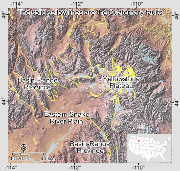
The key objective of this project is to investigate the driving mechanisms of crustal deformation in the greater Yellowstone region, including the Yellowstone Plateau, the Eastern Snake River Plain (ESRP), and the adjacent Basin-Range Province. I study the spatial and temporal patterns and extents of magmatic and tectonic deformation in the study region using space-based geodetic techniques (InSAR and GPS) and numerical modeling. In addition, I monitor the recent landslide activity at the southwestern end of ESRP using InSAR.
Samples from the project outputs are available in the next few pages and more results will be posted later. I will make the images of high resolution available for download and will provide them in Google Earth format as well. The JavaScript should be enabled in your web browser to be able to see the slides in the next pages. To browse the project web pages, please click here or clik "Next" below the image.